Salt Spring Island Active Transportation Network
Consultation has concluded
The Salt Spring Island Active Transportation Network Plan (ATNP) is complete and was presented to the Local Community Commission on July 18, 2023. You can view the plan here:
- Salt Spring Island Active Transportation Plan - Interactive (PDF)
- Salt Spring Island Active Transportation Plan - Print (PDF)
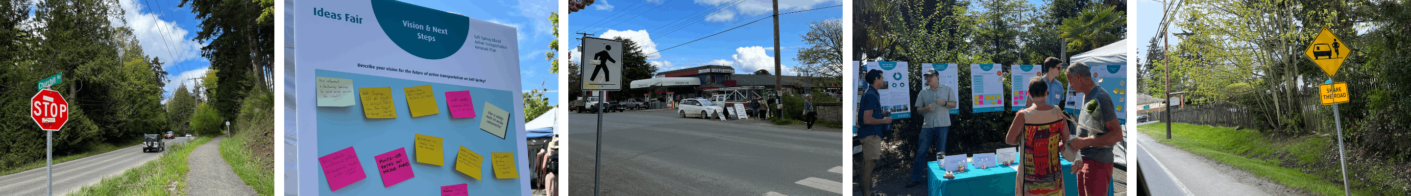
Thank you to the residents and visitors of Salt Spring Island who provided valuable feedback throughout the planning process. Public engagement guided the development of the ATNP to ensure its recommendations reflect the needs and priorities of Island residents and visitors. Feedback was used to create preliminary recommendations for pedestrian and cycling infrastructure options across the Island, which were then shared for additional review and input before developing the plan.
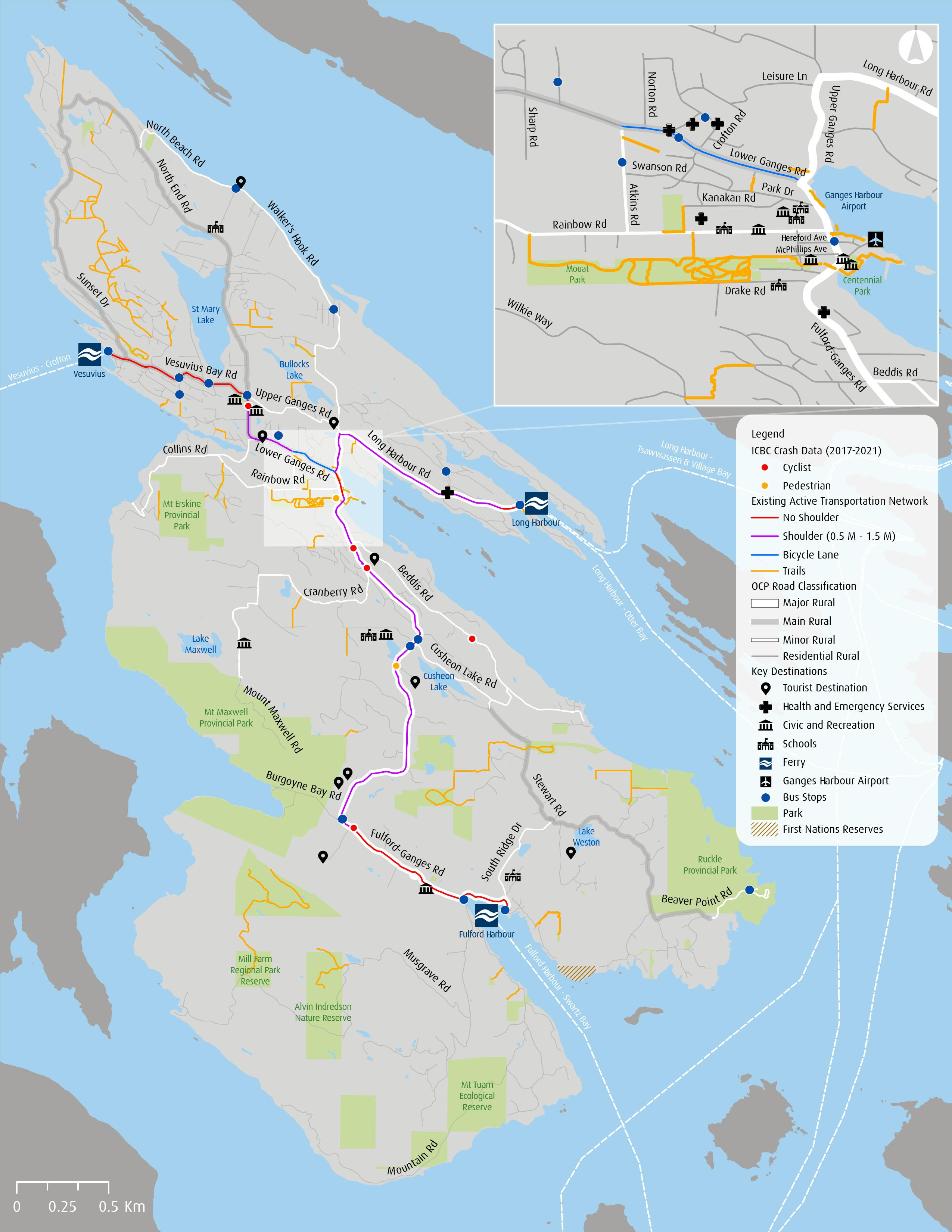
The ATNP builds on the 2013 Pedestrian and Cycling Master Plan and guides the development of the Island’s active transportation network over the next 10 to 20 years. The plan will address critical active transportation issues and help SSI manage transportation and demographic changes while improving quality of life, safety and mobility for residents and visitors. The CRD obtained funding from the BC Active Transportation Grants Program to support the cost of developing the Salt Spring Island Active Transportation Network Plan (ATNP).
The project had four phases, as shown below:

What is Active Transportation?
Active transportation, as defined in the BC Active Transportation Design Guide, includes any form of human-powered transportation, including walking, cycling, or rolling using a skateboard, in-line skates, wheelchair or other wheel-based forms of human-powered transportation.
What is an Active Transportation Network Plan?
An Active Transportation Network Plan is a strategic document that lays out the vision and key goals for how Salt Spring Island will enhance its active transportation. The purpose of the ATNP is to identify gaps in the pedestrian and cycling network, improve the quality and experience for people walking, biking, and rolling, provide a roadmap for high priority improvements over the next 10-20 years and increase the share of trips completed by active modes of transportation.

Documents
-
 Salt Spring Island Active Transportation Network Plan - Interactive.pdf (86.7 MB) (pdf)
-
Salt Spring Island Active Transportation Network Plan - Print.pdf (32.4 MB) (pdf)
-
SSI ATNP Engagement Summary_Final_2022-12-06.pdf (7.12 MB) (pdf)
-
Salt Spring Island ATNP_Baseline Conditions Report_Final_2022-11-21_Rev-1.pdf (6.06 MB) (pdf)